Hiking

Oberrieder Dog Park

The happiest place on earth

Latitude
33° 58' 18.48"
Longitude
-119° 34' 45.80"

Oberrieder Dog Park is a large, partially shaded woodchip covered enclosure for dogs and humans to relax and enjoy the company of other dogs (and humans). It is next to a beautiful walking path along the oberreider wetlands with views of the bluffs under LMU. This path easily connects to the Bluff Creek Trail for the back half of a 4.5 mile loop.
Del Rey Lagoon

The Lagoon beside the beach

Latitude
33° 57' 36.00"
Longitude
-119° 32' 60.00"

Del Rey Lagoon is a 14-acre park in the beach neighborhood of Playa Del Rey. This park features lighted baseball fields, basketball courts, and playground. There is a parking lot availability for visitors.

Ballona Wetlands

Ecological Preserve

Latitude
33° 57' 56.16"
Longitude
-119° 33' 38.52"

Ballona contains a complex mosaic of habitats defined mainly by hydrology, including wetland habitats, such as brackish and freshwater marshes, seasonally flooded freshwater wetlands, salt pans, riparian and upland habitats, like coastal sage scrub and sand dunes. Many wildlife species, especially birds, utilize more than one habitat type – thus the juxtaposition of these habitats next to one another, also known as heterogeneity, which is important for biodiversity.

Ballona Creek Bike Path

Part of Park to Playa Trail

Latitude
33° 57' 56.02"
Longitude
0° 00' 00.00"

The Ballona Creek Bike Path parallels Ballona Creek while connecting the Pacific Ocean at Marina Del Rey with Culver City. The trail connects with a beach path that continues south to Redondo Beach while at the north, Dusquesne Avenue connects the bike path with the eastern portions of the Park to Playa Trail.

Jet Pets

Private dog friendly open space

Latitude
33° 57' 27.00"
Longitude
-119° 33' 57.60"

Jet Pets is an animal transportation company located in Playa Del Rey very close to LAX. They have a large field on their property that is fenced in and they keep it open most days and allow you to walk your dog there.

Bluff Trail

The western extension of the Bluff Creek trail

Latitude
33° 57' 53.28"
Longitude
-119° 34' 21.76"

A short 1.5 mile trail located just west of LMU along the bluff beside the One Westbluff neighborhood. This trail has views of the ocean, the marina and the Ballonas Ecological Preserve.

Bluff Creek Trail

AKA LMU Trail, AKA Westchester fireroad trail

Latitude
33° 58' 31.08"
Longitude
-119° 35' 17.16"

The Bluff Creek trail is a nice mostly flat partially paved/dirt path that traverses the bluff just under LMU. Recommended as a loop with a couple mile trail and then couple miles walking in Playa Vista through Oberrieder park.

Westchester, Playa Del Rey, and Playa Vista Hiking Guide

Great hiking near LAX

This part of Los Angeles has a lot of surprisingly remote feeling hikes. Located just north of LAX these three neighborhoods have a beach, the second largest open space in Los Angeles (ballona wetlands), and a bluff side hiking trail with expansive city, mountain and ocean views.

Join alltrails using this link and they will plant 2 trees after you join.
AllTrails

Hiking

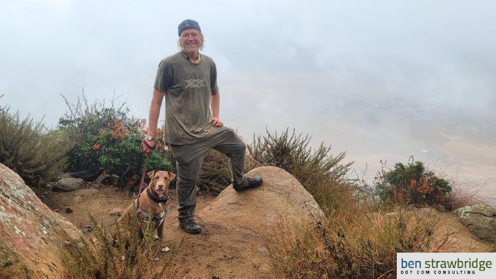
Ben and Rhys on Bishop Peak

Maps, Guides and Logs

One of my greatest joys is being outdoors in a wide open space with nothing made by man in sight. At times, I do have to come back to reality, and occasionally when I do, I will share routes, guides, maps, and from time to time, gear recommendations.

Join alltrails using this link and they will plant 2 trees after you join.
AllTrails